OmniGeo and WatchPost Bring Satellite AI Vegetation Management to Mountain West Co-ops
Colorado partnership pairs spectral satellite AI with hyperlocal weather to move electric co-ops from cycle-based to
Press Release Disclaimer: This is a press release distributed through the XPR Media network. It has not been independently verified by our newsroom.

Colorado partnership pairs spectral satellite AI with hyperlocal weather to move electric co-ops from cycle-based to risk-based tree trimming
BOULDER, CO, UNITED STATES, November 17, 2026 /EINPresswire.com/ — OmniGeo, a Boulder-based physical risk intelligence company, today announced its satellite AI utility vegetation management service for electric cooperatives, delivered with partner WatchPost. Launched at the Colorado Rural Electric Association’s Energy Innovation Summit, the service is now being rolled out with a Colorado electric cooperative and is available to co-ops across the Mountain West ahead of their 2027 budget cycles.
U.S. utilities spend an estimated $8.7 billion a year keeping vegetation clear of their lines, according to Straits Research, and electric cooperatives carry an outsized share of that work. America’s 830 distribution co-ops maintain about 42% of the nation’s distribution lines across 56% of its landscape, according to the National Rural Electric Cooperative Association.
Yet existing vegetation management platforms were built for the largest investor-owned utilities, as enterprise suites designed around large vegetation departments. Co-ops work differently: a small team covering thousands of miles of rural line. They don’t need more software. They need better measurement: which spans are most likely to start a fire, how dry the fuel is, and evidence the work was done.
Most co-ops still manage that risk by hand. A 2026 benchmark survey of 50 electric cooperatives co-published by the Utility Arborist Association found that 72% run vegetation management on spreadsheets and only 28% use drone or aerial imagery.
Regulators are raising the bar. Texas House Bill 145, enacted in 2025, requires electric cooperatives with lines in wildfire risk areas to file wildfire mitigation plans that include a detailed vegetation management plan. Wyoming, Utah and Montana have adopted their own co-op plan requirements.
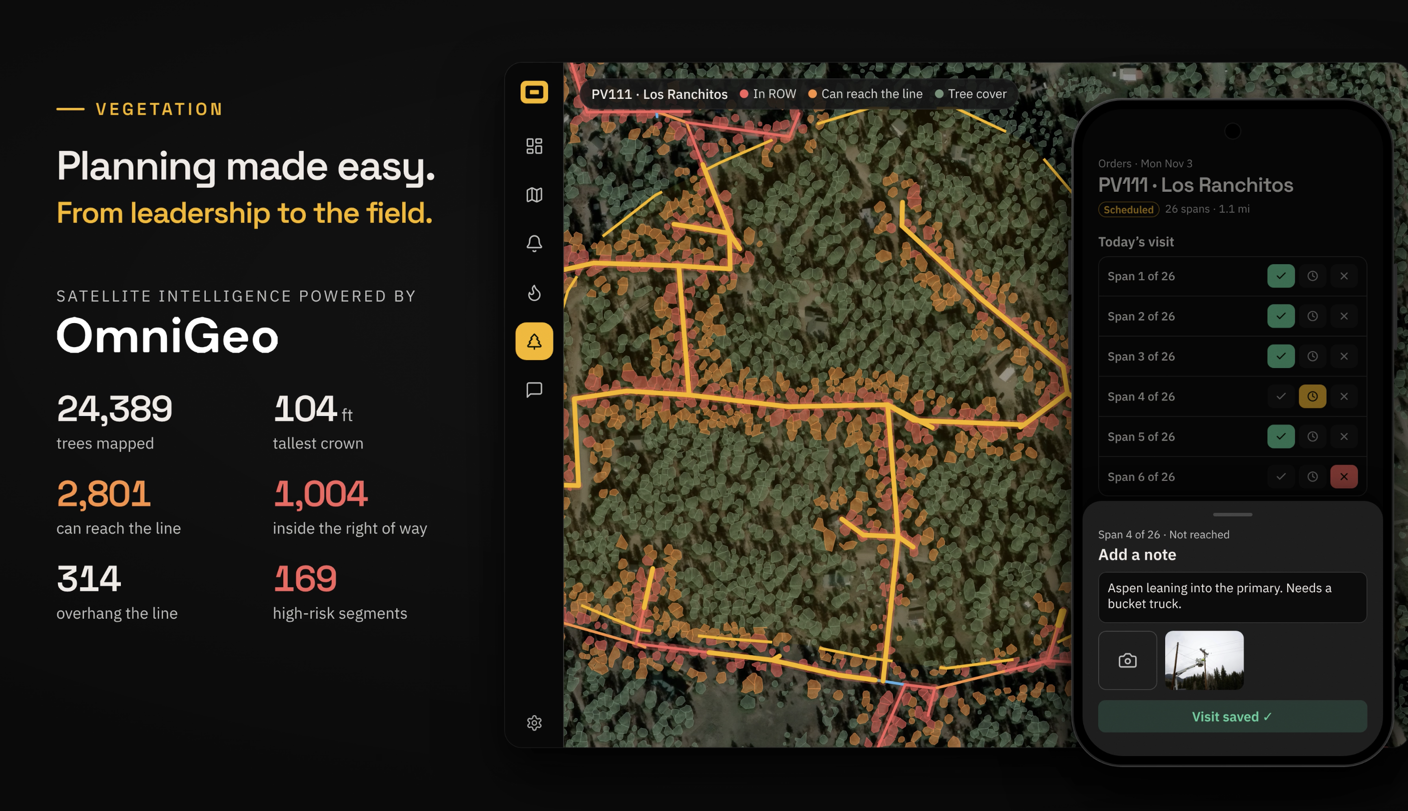
OmniGeo gives co-ops the evidence those plans require, without new field crews. Using high-resolution satellite and aerial imagery and physics-based spectral analysis, OmniGeo measures vegetation along every mile of overhead line: encroachment and clearance from the conductor, hazard trees, and the condition of the fuel itself, including live fuel moisture and whether vegetation is cured or live. Repeat imagery provides before-and-after change detection, so co-ops can verify trimming and document it for boards, insurers and regulators.
WatchPost combines OmniGeo’s vegetation measurements with its hyperlocal weather data, so operations teams can see which spans pair the worst vegetation with the worst fire weather and send crews there first.
“Some of the most destructive fires in recent history started at power lines, including the Marshall Fire here in Boulder County, where my partner lost his home,” said Raviv Turner, Co-Founder and CEO of OmniGeo. “Co-ops are being asked to prove they’re managing wildfire risk with the same small teams and spreadsheets they’ve always had. Satellites can now measure every mile of line, including how dry the vegetation is. That lets a co-op trim by risk instead of by calendar, and show its board and regulators exactly why.”
“The value of satellite vegetation intelligence goes far beyond prioritizing where to trim, but that value can’t be unlocked in a silo,” said Josh Shewbridge, Co-Founder and CEO of WatchPost. “When co-op leaders face high-stakes calls like staging crews, changing grid settings, or initiating a PSPS, those decisions need to be data-backed and defensible. Neither vegetation risk nor a regional weather forecast can get them there alone. Combining vegetation risk with grid-level forecasting and hyperlocal conditions at the asset gives operators a clear picture on the days that matter most.”
OmniGeo and WatchPost are offering Mountain West electric cooperatives a no-cost pilot on a portion of their line miles ahead of 2027 budget planning. Co-ops can request a pilot at omnigeo.ai.
About OmniGeo
OmniGeo is a Boulder, Colorado-based physical risk intelligence company. Its spectral AI measures the material and condition of assets, giving utilities and insurers asset-level evidence of wildfire and other physical risks. Learn more at omnigeo.ai
About WatchPost
WatchPost is a Denver, Colorado-based weather intelligence company. By combining its utility-grade weather stations with grid-level forecasting and historical operating records from its co-op partners, WatchPost turns generic weather forecasts into hyperlocal grid risk, helping operators boost reliability and make high-stakes decisions they can defend. Learn more at watchpost.net
Press
OmniGeo
press@omnigeo.ai
Visit us on social media:
LinkedIn
OmniGeo Utility Vegetation Management
Legal Disclaimer:
EIN Presswire provides this news content “as is” without warranty of any kind. We do not accept any responsibility or liability
for the accuracy, content, images, videos, licenses, completeness, legality, or reliability of the information contained in this
article. If you have any complaints or copyright issues related to this article, kindly contact the author above.

Media gallery